 Introducing 3D Laser Scanner P40 In India. Please visit
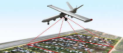
With many years of research and real life experience in all territories of the Geographical Information System (GIS) domain, we provide successful and accurate execution of your GIS related projects. For any research project, the essential and important point with GIS mapping data is registering a map with the correct real world coordinates. If the maps are not georeferenced, no other information can be displayed over or positioned under the map coverage. With our GIS services, we offer accurate georeferencing / geocoding of your projects at affordable prices. We are capable of various geospatial analytical procedures for users in agriculture, transport, electrical network, water supplies, sewage, etc.
GIS services:
- Utility Mapping
- Route Network Analysis
- Digitization/Vectorization
- Water Resources Planning
- GCP Data Capture and analysis
- Topographical and Cadastral mapping
- Image GeoRectification / Georeferencing
- Rural/Urban:Planning,Development&Management
Our Recent Projects
| S.No | Client Name | Scope Of Work |
|---|---|---|
| 1 | ABU DHABI BREAKWATER DEVELOPMENT | PREPARTION OF DRAWING FOR TRAFFIC SIGNAL IN ARCGIS |
| 2 | Sas Al Nakhl Project No.7003 | ARCGIS FOR STROM WATER & STREET LIGHTING POLES DRAWINGS |