 Introducing 3D Laser Scanner P40 In India. Please visit
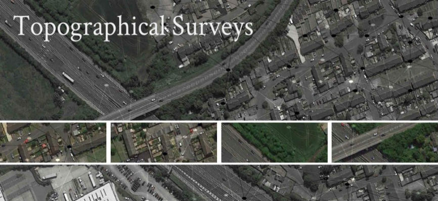
The purpose of a TOPOGRAPHICAL SURVEY is to gather survey data about the natural and man-made features of the land, as well as its elevations. From this information a three-dimensional map may be prepared. You may prepare the topographic map in the office after collecting the field data by GPS or Total Station.
Establishing horizontal and vertical controlthat will serve as the framework of the survey.Determining enough horizontal locationand elevation of groundpoints to provide enough data for plotting whenthe map is prepared.Locating natural and man-made featuresthat may be required by the purpose of the survey.Topographical survey determines the characteristics of the details found on the surface (locations of the buildings, roads, etc) of the earth and based on these inputs topographic maps are prepared.

Our Recent Projects
| S.No | Client Name | Scope Of Work |
|---|---|---|
| 1 | EMAAR PROPERTIES PJSC | TOPOGRAPHIC SURVEY FOR MBR DUBAI HILLS ESTATE |
| 2 | PARSONS OVERSEAS LIMITED | TOPOGRAPHIC & FEATURES SURVEY WORKS FOR TEEJAN M8 & M10 DEVELOPMENT DUBAI, UAE |