 Introducing 3D Laser Scanner P40 In India. Please visit
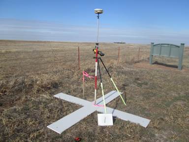
Ground control points are large marked targets on the ground, spaced strategically throughout your area of interest. If you use ground control points with your aerial map, you first need to determine the RTK GPS coordinates at the center of each.
GCPs greatly increase the global accuracy of drone maps. Although they are not necessary in every situation, GCPs are a vital tool for precision mapping.